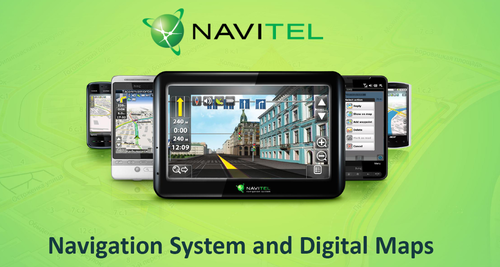
GPS Map of Mongolia and Navitel Navigator
GPS Map of Mongolia for Navitel Navigator
Detailed maps for entire Mongolia scale and Ulaanbaatar city. The map interface is on Mongolian language and voice guidance. Local address system, search engine compatibilty map database.
“Navitel Navigator” is a unique and accurate navigation system, including detailed map of Russia and free services “Navitel.Traffic”, “Navitel.SMS”, "Navitel.Events", "Dynamic POI" and “Navitel.Weather”. Information about speed cameras location is also included (SPEEDCAM).
New version features (Navitel Navigator):
- Navitel.Traffic — free traffic jams information service;
- Navitel.SMS- free service of exchanging coordinates;
- 3D maps — 3D buildings and road junctions;
- Navitel.Events — information about road accidents, roadworks and mobile speed cameras;
- Dynamic POI — gas prices, showtimes at cinemas and different sales information;
- Easy and intuit interface;
- Precise and in-time voice hints;
- Intellectual map search system;
- SPEEDCAM warnings.
Main "Navitel Navigator" options:
Navitel.Traffic is a free service. All Navitel Navigator users automatically inform server about street traffic if the service is activated. Your speed is anonymously sent to the analytics server, where the data is being collected and processed. The server sends backwards collected traffic information so you can see colored lines on map and device can create an optimal route using traffic jams* information.
*Navitel.Traffic is displayed only on maps, built by Navitel.
“Search” service —finds everything!
This service can use Russian type of address (which includes double addressing, housings, etc.) With the exact destination Navitel Navigator can find it on the map easily, and the hint search system (T9-like) will help you to find street names faster and easier.
“Routes”. Creating routes in a city and in a country is one of the main functions of the navigation system. Navitel Navigator automatically creates optimal route and allows you to set it as you want.
“SPEEDCAM”. More and more speed control cameras are installed at the dangerous road sections. To warn driver about it, we created special notification system. With it, driver can notice dangerous road section in advance and slow down the speed. The speedcam database constantly updates by our cartographers and community. Speedcams file contains information about speed control cameras, dangerous intersection, speed bumps and railway crossings.
“Navitel.SMS”. Free service. It allows you to send SMS with your coordinates. The recipient’s Navitel Navigator software can show received coordinates on map and create a route to it.
“Navitel.Events” - a new free interactive service allows users to fix and see on the map other users marks of the various types of road events, such as road accidents, car crashes, roadworks, speed cameras and other warnings.
“Dynamic POI”. The service provides exhaustive and actual information about different types of POI on the country map, including information about gas prices on petrol stations, actual showtimes at cinemas, detailed information about cafes and restaurants, including special offers and telephone numbers for bookings, etc.
Different map search types:
- Nearest object in specified radius.
- Municipalities and objects, located in town (by type and name).
- Address search.
- Points of interest search (POI).
- Waypoint search.
- Last found objects search.
- Road crossings search.
More options:
- Voice guidance while driving on the route.
- Movement speed and direction.
- Coordinates (latitude and longitude, altitude).
- Automatic time zone selection.
- Odometer, time while driving, average, minimum and maximum speed.
- Track and waypoint record.
- Track import/export.
- Route import/export.
- Direction to the end point and approximate arriving time.
- Information about Glonass/GPS satellites.
- Option of program using without stylus. Finger-friendly interface (for drivers large virtual buttons on touchscreen devices).
- Voice hints.
- Option of several different voice packages and connection of your own voice package.
- Russian, English, Spanish, Turkish and other interfaces.
- More than 100 of different sensors (dashboard).
- Automatic GPS/GLONASS receiver setting: you don’t need to select COM-ports and protocols.
- Automatic Bluetooth on/off while connecting external GPS/GLONASS receiver.
- Different skins.
Useful links:
Navitel Navigator license agreement
Operation system requirement
Windows Mobile, Android, Symbian, Samsung Bada OS.
Windows Mobile 5.0, 6.0, 6.1,6.5.
Android 1.5, 1.6, 2.0, 2.1, 2.2, 2.3
Symbian S60 9.4. 3rd Edition, 5th Edition
Bada 1.0, 1.2
Hardware requirement
Windows Mobile 5.0, 6.0, 6.1,6.5.
Supported interface:sensor.
Supported resolutions:240×240, 320×240 (QVGA), 400×240 (WQVGA), 480×320 (HVGA),640×480 (VGA), 800×480 (WVGA).
Free RAM,when starting program: at least 25mb.
Free ROM:20mb.
Android OS: 1.5, 1.6, 2.0, 2.1, 2.2Supported interface:sensor.
Supported resolutions:: 320×240 (QVGA), 400×240 (WQVGA), 480×320 (HVGA),640×480 (VGA), 800×480 (WVGA).
Free RAM,when starting program: at least 25mb.
Free ROM from Market:25mb.
Free ROM from apk: 88mb.
List of not supported devices: Highscreen Ice, Archos.
Symbian: S60 3rd edition, S60 5th edition
Supported interface:sensor for S60 5th edition, sensor or button keyboard for S60 3rd edition
Supported resolutions: 320×240 (QVGA), 640×360.
Free RAM,when starting program: at least 25mb.
Free ROM :12mb.
List of not supported devices:Sony Ericsson Satio U1.
Bada: 1.0, 1.2
Supported interface:sensor.
Free RAM,when starting program: at least 25mb.
Free ROM :25mb.
List of supported devices:Wave II (S8530), Wave (S8500).
